






Colorado’s four most active wildfires — the Aspen Acres, Gold Mountain, Elk and Willow fires — have together consumed nearly 150,000 acres, or 233 square miles. That’s roughly the size of Chicago.
Jump to: Aspen Acres fire | Gold Mountain fire | Elk fire | Willow fire | Air quality alerts
Aspen Acres fire in Custer and Pueblo counties
Custer County residents previously allowed to return home were placed back under mandatory evacuation orders, and another zone’s scheduled repopulation was canceled as fire activity increased on Monday.
As of Tuesday morning, the Aspen Acres fire had consumed 101,546 acres and was 61% contained. It’s Colorado’s largest active wildfire and the seventh-largest fire in the state’s recorded history, behind the 2018 Spring Creek fire that consumed 108,045 acres, according to the Colorado Division of Fire Prevention and Control.
The fire grew nearly 1,000 acres on Monday “amidst near-critical fire conditions,” officials said in a morning update.
Tuesday is expected to bring lower temperatures and higher humidity, which will decrease fire activity, according to fire officials.
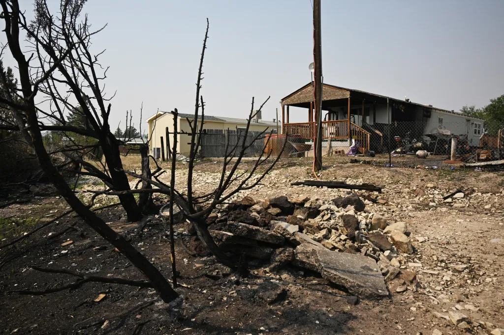
Fire officials have said the Aspen Acres fire has destroyed close to 900 structures, at least 337 of which are homes, according to law enforcement in Pueblo and Custer counties.
Mandatory evacuations remained in effect Tuesday south and west of the fire’s 157-square-mile burn area. Updated evacuation maps for Pueblo and Custer counties are available online, as well as a map showing the areas where residents are allowed to return home.
Residents of zone C3, north of Beaver Creek in Custer County, were slated to return home on Tuesday, but that re-entry was canceled on Monday. Further north, mandatory evacuations were reissued for zone C4, from Colorado 165 to the Pueblo County line.
Across the county line from those two zones, evacuation orders were lifted in Pueblo County for zones FS3 and FS4. Those zones include Bear Canyon and homes along South Pine Drive and Middle Creek Canyon Road, according to the map.
More than 1,200 fire personnel remained on scene Tuesday to fight the wildfire.
The following roads remained closed for the fire on Tuesday, according to the Colorado Department of Transportation:
- Colorado 165 in both directions between McKenzie Junction and Interstate 25
- Colorado 78 in both directions between Colorado 165 and Rock Creek Road west of Pueblo
The exact origin of the fire remains under investigation, but officials believe it was human-caused.
Gold Mountain fire near Ouray
As of Tuesday morning, the Gold Mountain fire north of Ouray had consumed an estimated 38,044 acres with 24% containment. That’s roughly 59 square miles.
The wildfire has not seen significant growth in about a week, but the crews are still working on containment.
“Local thunderstorms may produce lightning, strong outflow winds, and sudden flash floods in steep terrain and drainages, so the public should stay alert to changing conditions,” fire officials wrote in a Tuesday morning update. “With increased moisture coming into the area, flash flooding is a real concern.”
Read more Interstate 70 closed near Glenwood Springs for mudslides
More than 900 personnel were on scene to fight the wildfire on Tuesday, according to Rocky Mountain Complex Incident Management Team 2, which is leading the fire response.
Mandatory evacuations remained in place on Tuesday for residents of Ouray and Gunnison counties north of the fire, according to the evacuation map.
The Ouray County evacuation zone was bordered to the west by County Road 8 and County Road 10, to the south by Baldy Peak, to the east by Green Mountain and the Cimarron Ridge and to the north by Tommy Creek and Deer Creek.
Evacuations were also in effect northeast of the Cimarron Ridge, along the border of Gunnison and Montrose counties, according to the map. That area is bordered to the north by Washboard Rock, to the east by Gunnison County Road 864A, to the south by Hampden Lake and to the west by Cimarron Ridge.
Montrose County residents north of the mandatory evacuation zone and Gunnison County residents to the east of the zone were on pre-evacuation status at that time.
The cause of the Gold Mountain fire, which sparked shortly after 5:30 p.m. on June 27, remains under investigation
Elk fire near Lake City
As of Tuesday, a lightning-sparked wildfire burning east of Ouray’s Gold Mountain fire had consumed roughly 2,307 acres with no containment, according to fire officials. That’s nearly 4 square miles.
The Elk fire started on July 9 north of Lake City.
Mandatory evacuation orders remained in place on Tuesday around the fire, including residents north and west of Lake City, from the Independence Gulch Trailhead to the Hinsdale County line, officials said. Residents west of Colorado 149 were on pre-evacuation orders.
An evacuation center is available at the Lake City Armory, 230 N. Bluff St., according to county officials.
Willow fire near Leadville
The Willow fire had consumed roughly 7,181 acres with 41% containment as of Monday morning, according to fire officials. The burn area covers roughly 11 square miles.
A size update was not yet available on Tuesday.
Mandatory evacuations remained in place Tuesday for an area bordered to the north by Lake County Road 9, to the west by Twining Peak, to the south by Lake County Road 11 and to the east by Derry Ditch. Updated evacuation information can be found online.
More than 1,130 structures are threatened by the fire, though no structures have been destroyed, according to a Monday morning update from California Interagency Incident Management Team 8, which is leading the fire response.
Investigators believe the fire, which started on June 28, is human-caused, but the exact details of its origin were not available. As of Tuesday morning, 696 personnel were on scene to fight the wildfire, according to fire officials.
Fire officials said 13 injuries have been reported from the fire, but did not specify if those injured were firefighters or civilians.
Read more How an investor capitalized on Denver’s neglected property problem
Get more Colorado news by signing up for our Mile High Roundup email newsletter.